




BEYLINE AERIAL SERVICES
DJI Matrice 4 Enterprise
Provided by Beyline Aerial Services
Videos

About the Service
Utility & Electrical Infrastructure
Distribution Pole Inspections – Captured detailed aerial imagery and asset data for utility distribution poles.
Transmission Tower Inspections – Conducted high-resolution aerial inspections of transmission structures and components.
Power Infrastructure Mapping – Collected aerial data used to document utility corridors, equipment, and infrastructure.
Utility Clients/Projects – Experience supporting projects associated with Hawaii Electric, Southern California Edison, Texas-New Mexico Power, CVEC, NextEra Energy, Florida Power & Light, Bluegrass Energy, and National Grid.
Telecommunications
Cell Tower Inspections – Performed aerial inspections and documentation of telecommunications towers.
Verizon Projects – Captured detailed tower imagery and inspection data.
American Tower Projects – Conducted aerial tower inspections and asset documentation.
Tower Photography & Data Collection – Captured multiple perspectives and detailed imagery for structural and equipment documentation.
Roofing & Building Inspections
Commercial Roof Inspections – High-resolution aerial imagery for evaluating roof conditions and documenting defects.
Georgia International Convention Center – Conducted/planned large-scale aerial roof inspection and mapping work.
Orthomosaic Roof Mapping – Created aerial mapping products to provide a comprehensive view of large roof surfaces.
Commercial Building Documentation – Collected aerial imagery and 3D data for large commercial facilities.
3D Mapping & Photogrammetry
3D Photogrammetry – Created detailed 3D models from aerial imagery.
Orthomosaic Mapping – Produced high-resolution orthomosaics for large properties and infrastructure.
RTK Mapping – Performed high-accuracy aerial mapping using RTK workflows.
Oblique Mapping – Captured angled imagery for structures requiring detailed side and facade documentation.
Point Cloud Generation – Produced aerial point-cloud data for mapping and analysis.
KML/DXF Deliverables – Generated mapping files for use in GIS, CAD, and engineering workflows.
Construction & Site Mapping
Construction Progress Monitoring – Documented construction sites and project progress through recurring aerial missions.
Large-Site Mapping – Captured extensive commercial and industrial properties for mapping and documentation.
Site & Terrain Mapping – Collected aerial data for understanding site conditions, elevations, and property layouts.
Pavement & Property Inspections
Pavement Inspections – Aerial documentation of parking lots, roadways, and commercial pavement areas.
Property Inspections – Captured comprehensive aerial imagery for commercial and industrial properties.
Insurance Property Documentation – Collected imagery used for property condition documentation and insurance-related applications.
Roof & Exterior Condition Documentation – Used aerial imagery to document building exteriors and areas difficult to inspect from the ground.
Specialized UAS Operations
Class B Airspace Operations – Experience planning and conducting missions in the Atlanta-area airspace environment.
FAA Authorization Missions – Prepared operational safety justifications and coordinated missions requiring FAA authorization.
Large Commercial Sites – Experience planning missions involving large facilities, multiple flight areas, visual observers, and defined emergency procedures.
High-Resolution Data Collection – Experienced in producing professional aerial datasets rather than simply capturing photographs.
Drone Models Supported:
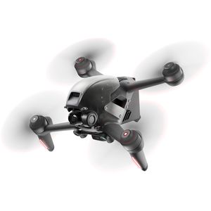 DJI FPV
About the Drone
DJI Matrice 4E – Key Advantages
4/3-inch 20 MP camera for high-resolution inspections and mapping.
Mechanical shutter ideal for accurate photogrammetry and orthomosaic mapping.
48 MP telephoto cameras provide detailed imagery of towers, poles, buildings, and other hard-to-reach assets.
Smart 3D Capture & oblique imaging for detailed 3D models and complex structures.
Laser rangefinder for distance and measurement capabilities.
Up to 49 minutes of flight time for efficient large-site operations.
Fast image capture designed specifically for mapping and surveying.
Advanced obstacle sensing and flight safety features for professional inspection environments.
Best suited for: utility inspections, transmission towers, cell towers, commercial roofs, pavement, 3D photogrammetry, orthomosaic mapping, construction monitoring, and property inspections.
Experience

Construction
Insurance Claims
Real Estate
Utilities
Pipelines
Clean Energy
Drone Features
Drone
Maximum Flying Time:
49 minutes
Pricing
Price
$150.00
Cancellation
Flexible
Weekly Discount
10%
Monthly Discount
15%
Location