
ProAerialPics.com full service
DJI Inspire 1 Pro
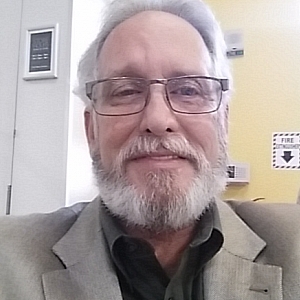
Provided by RONALD
Videos
About the Service
We have sUAV Video & Photography experience including movie footage, survey maps, 3D modeling, 360 degree panorama, crop evaluations including plant health, drainage and acreage, school, church, vineyard, and real estate with high quality aerial photographs and 4K High Definition video. All are available with same day service. If you need detailed daily construction updates including work completed, measuring the cubic volume and square footprint of material to be moved or precise acreage and distance give us a call. For insurance inspection a 3D model can be made to check damage from almost any angle. ProAerialPics is your Drone Video and Photography service for any application you may have that falls under FAA flight and safety rules.
Drone Models Supported:
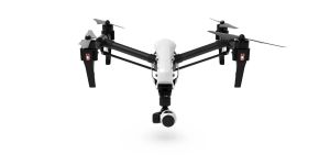 DJI Inspire 1
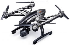 Yuneec Q500 Typhoon 4K
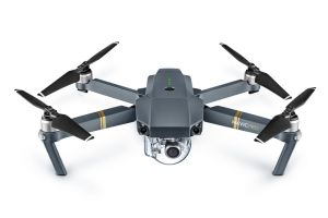 DJI Mavic Pro
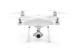 DJI Phantom 4 Professional
About the Drone
We use drones your job requires from a DJI Panton 4 to a DJI Inspire Pro with Zenmuse X5 camera. With two separate operators and controls we provide flight and 360 degree camera operation only limited to your imagination, the weather and FAA regulation
Experience
Construction
Agriculture
Insurance Claims
Real Estate
Utilities
Pipelines
Clean Energy
Cinematography
Drone Features
Camera
Still Camera Resolution:
16.0 megapixels
Built-in Camera:
Yes
Camera Control Range:
-90 to +30 °
View All
Controller
Control Type:
5000.0 meters
Mobile Device Holder:
Tablet
Live View:
Yes
Control Type:
Remote Control + Phone/Tablet
View All
Drone
Weight:
2870.0 grams
Maximum Flying Time:
15.0 minutes
Maximum Flying Speed:
18.0 m/s
Maximum Flying Altitude:
120 meters
View All
Extras
SD Card Types:
Micro SD
Pricing
Price
$950.00
Cancellation
Strict
Weekly Discount
20%
Monthly Discount
50%
Location