Aerial Data Specialists
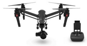
DJI Inspire 1 Pro
Provided by Apis Insights
About the Service
We can provide, not only a new perspective from above, but due to the precision we possess, we can also provide that perspective over time. Be it a construction site being reported on for remote investors or a farmer wanting to see how the health of their crops are doing throughout the season. We are more than happy to assist you in obtaining whatever aerial perspective suits your needs.
We have been working in commercial and residential Real estate, along with agricultural and videography work. We work with a local conservancy's efforts, flying recognizance of some local rivers and creeks to support salmon and trout habitat studies. Recently we've been involved in a first responder project. Getting some detailed aerial images for a planned video project featuring the local Police and Fire departments.
We are fully insured for liability. All our pilots are registered FAA certified remote pilots.
Drone Models Supported:
 DJI Inspire 1 Pro
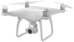
 DJI Phantom 4
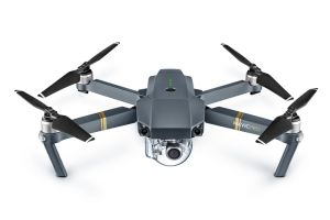
 DJI Mavic Pro
About the Drone
Our drones all carry 4K Ultra High Definition cameras and with GPS positioning can render some very unique shots, such as aerial based HDR photography. We can map a mission in a way that allows us to repeat that mission precisely.
Experience
Construction
Agriculture
Police
Fire
Real Estate
Utilities
Mining
Clean Energy
Cinematography
Drone Features
Camera
Still Camera Resolution:
16.0 megapixels
Built-in Camera:
Yes
Camera Control Range:
-90 to +30 °
View All
Controller
Mobile Device Holder:
Smartphone
Control Type:
5000.0 meters
Control Type:
Remote Control + Phone/Tablet
Live View:
Yes
View All
Drone
Weight:
2870.0 grams
Maximum Flying Time:
15.0 minutes
Maximum Flying Speed:
18.0 m/s
Maximum Flying Altitude:
120 meters
View All
Extras
SD Card Types:
Micro SD
Pricing
Price
$300.00
Cancellation
Flexible
Weekly Discount
20%
Monthly Discount
30%
About the Provider
Specializing in data acquisition by UAV (drone).
Aerial video and photography, agriculture health and infrastructure inspections
Verification
Email Address
Phone Number
FAA Drone Registration
FAA Remote Pilot Certification
Location


