
Commercial Aerial Imaging MAPPING
DJI Inspire 2
Provided by Commercial Aerial Imaging
Videos
About the Service
We provide our clients with critical drone thermographic inspections and information related to various aspects of their projects, such as their building envelope performance, insulation issues, electrical and mechanical overheating and component wear, moisture accumulation, solar panel operations, and structural irregularities.
We operate with a Level II Thermographer who is certified through FLIR's Infrared Training Center to execute in-person and drone inspection missions and help interpret the collected data and also make recommendations to improve operations.
Drone Models Supported:
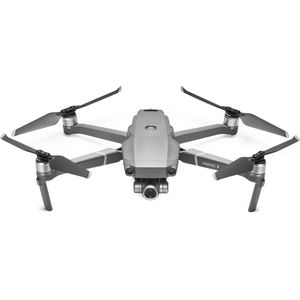 DJI Mavic 2 Zoom
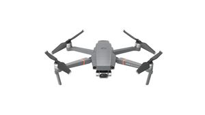 DJI Mavic 2 Enterprise Dual
About the Drone
We use a Mavic 2 Enterprise Advanced with a 512x640 thermographic resolution camera for thermal inspections and data collection. We use an Inspire 2 with a X4s 20MP global shutter for mapping applications. We use a Mavic 2 Zoom to offer our clients unique perspectives that are unattainable or unsafe to acquire with any other equipment.
Experience
Construction
Insurance Claims
Real Estate
Clean Energy
Drone Features
Controller
Mobile Device Holder:
Smartphone
Control Type:
7000 meters
Control Type:
Remote Control + Phone/Tablet
Live View:
Yes
View All
Customizations
Thermographic Camera:
512x640
Optical Zoom:
2X
Drone
Weight:
3290 grams
Maximum Flying Time:
27 minutes
Maximum Flying Speed:
30 m/s
Maximum Flying Altitude:
2500 meters
View All
Extras
SD Card Types:
Micro SD
Pricing
Price
$200.00
Cancellation
Regular
Weekly Discount
25%
Monthly Discount
35%
About the Provider
Commercial Aerial Imaging was formed with a passion for safety, precision, technology, and the ability to push the boundaries of efficiency. With over 25 years of direct, hands on multifaceted construction and agricultural experience we give value to our clients through an expert-to-expert experience. You, the client know what you are looking for and we will clearly communicate with you all your needs to give you the most for your project. If you are new to utilizing aerial photography and drone inspection or have used UAV's in the past for a project, our thermographic inspections process at Commercial Aerial Imaging will leave you with results that will redefine your new standard.
Verification
Email Address
Phone Number
FAA Drone Registration
FAA Remote Pilot Certification
Location