

That Drone Guy USA
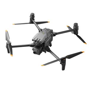
DJI Matrice 4 Enterprise
Provided by That Drone Guy USA
Videos
About the Service
As a skilled, professional drone pilot, I offer exceptional piloting expertise and much more. Under the privileges secured with my FAA Part 107 certification, I operate several drones from my fleet; the DJI Matrice 4E for precision mapping and surveying, the DJI Matrice 4T for thermal inspections, the DJI Mavic 3 Multispectral for agricultural analysis, and the DJI Mavic 3 Pro for cinematography. My projects range from solar farm surveys to historical documentaries and everything in between. I consistently deliver high-quality data and visuals, helping to ensure client success.
Beyond piloting, I also bring 35 years of experience operating at senior levels in corporate America and am a master of strategic planning and leadership. My advanced degrees in physics, mathematics and computer science give me the edge in understanding the underlying science and associated algorithms used to provide meaningful data analysis as required to draw conclusions from collected data. I am able to analyze complex datasets, develop custom processing workflows, and integrate results into automated tools and reporting. I'm also experienced in navigating the FAA exception approval process, securing FAA waivers for flights over 400 feet AGL in rural areas, and gaining approval to operate in otherwise restricted airspace when the need arises.
This unique combination of technical prowess, corporate insight, and operational excellence sets me apart. I’m not just a drone pilot—I’m a problem-solving innovator ready to elevate your projects with tailored solutions.
Drone Models Supported:
 DJI M30T
 DJI Mavic 3 Multispectral
 DJI MAVIC 3 Pro
About the Drone
I have several drones, each tailored for specific applications.
DJI Matrice 4E - Mapping and Surveying.
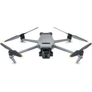
DJI Matrice 4T - Thermal inspections (roofing, solar, powerline, etc.), Search and Rescue
DJI Mavic 3 Multispectral - Agricultural analysis including plant health and growth.
DJI Mavic 3 Pro - Cinematography.
Experience
Construction
Agriculture
Real Estate
Utilities
Clean Energy
Cinematography
Drone Features
Drone
Maximum Flying Time:
49 minutes
Pricing
Price
$150.00
Cancellation
Flexible
Weekly Discount
20%
Monthly Discount
30%
About the Provider
With a background in computer science, mathematics, and astrophysics, I bring a data-driven, scientific and solutions-based approach to drone operations. As an FAA Part 107 certified drone pilot, I specialize in aerial photography and videography, search & rescue (including locating lost pets), aerial surveying, and agricultural applications using advanced UAV technology.
My fleet includes the DJI Matrice 4T, designed for high-precision thermal imaging and emergency response, the DJI Matrice 4E for advanced mapping and 3-D modeling, and the DJI Mavic 3 Multispectral, ideal for precision agriculture health analysis, preparation for crop fertilization and pest and disease prevention, and land management.
For cinematography, I use a Mavic 3 Pro high-definition video and photography aircraft. I specialize in sporting events, corporate advertisements, real estate and music video production.
With decades of technical expertise and a passion for innovation, I provide reliable, high-quality aerial solutions tailored to the unique needs of my clients. Whether it is assisting emergency teams, finding a lost pet, optimizing agricultural yields, or capturing critical aerial data, my goal is to deliver actionable insights and comprehensive solutions using cutting-edge drone technology.
Verification
Email Address
Phone Number
FAA Drone Registration
FAA Remote Pilot Certification
Location