Drone Pilot Media
DJI Mavic 2 Zoom
Provided by Drone Pilot Media
About the Service
My name is Matthew Mataya and I am a commercial drone pilot with an active part 107 UAS license # 4136823. I carry a one-million-dollar general liability policy. I have logged over 100 hours of drone flight time and 150 hours as a senso photographer thru Precision Hawk. I have experience flying Parrott Be-Bop 2, Mavic Pro, Mavic Pro 2 zoom, Inspire 2 w/X5s & X-7 cameras. I own all my own equipment, my default drone is the Mavic Pro 2 with optical zoom, I use ND / PL filters when necessary. I can shoot indoor stills in all formats including auto- bracketing & HDR. I can also fly indoors with drones with slow cinematic movement. My aerial images also include 360 degree spherical, 180 degree vertical and horizontal interactive panoramas. My indoor & outdoor aerial video can be shot in 4K, 2K, 1080P UHD @ 24,25,30,60 and 120 frames per second, including time lapse format. I can color grade & edit using Adobe Photoshop and post edit video using Adobe Premiere Pro or Filmora Pro editing software.
I am experienced in the following:
• special event aerial photography & videography
• Real Estate Listings residential & commercial
• Roof Inspections
• Post video editing & color grading
• Inspecting high voltage transmission towers
• Flight planning using waypoint kml files.
• You tube channel & video platforms knowledge.
Drone Models Supported:
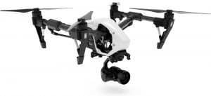
 DJI Inspire 2
About the Drone
DJI Mavic Pro 2 zoom
Experience
Construction
Insurance Claims
Real Estate
Clean Energy
Cinematography
Pricing
Price
$375.00
Cancellation
Flexible
Weekly Discount
15%
Monthly Discount
20%
About the Provider
We Provide Stunning Aerial Images & Aerial Video
for the following Industries
Residential Real Estate Listings - Give homebuyers a deeper impression of the neighborhood with the stunning views only aerial imagery can provide.
Commercial Real Estate Listings - Sell real estate faster and attract more clients by showcasing your property from the air. Aerial panoramas, images, and videos illustrate proximity to nearby amenities and elevate your offering memoranda.
Insurance Industry -
Improve operational effiency, enhance safety, and make better decisions with drone imagery. Be at the cutting edge of technology by using drones for aerial imagery needed to process a claim or underwriting inspection.
Construction / Site Monitoring / Survaying - Track, map, survey, and manage your worksite projects. Aerial imagery is the innovative solution to deliver sophisticated data analytics or provide a visual progress report to stakeholders.
Roof Inspections / Cell Tower Inspections -Be at the cutting edge of technology by using drones for roof inspections. Lower your operating costs and send pilots out to get the aerial imagery you need to process a claim or underwriting.
Verification
Email Address
Phone Number
FAA Drone Registration
FAA Remote Pilot Certification
Location


