

Comprehensive Aerial Mapping and Multispectral Analysis: DJI Mavic 3 with 20MP Mechanical Shutter by Hawkeye Drone Worx, LLC
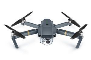
DJI Mavic 3 Multispectral
Provided by Hawkeye Drone Worx, LLC
About the Service
Welcome to Hawkeye Drone Worx, LLC, your premier destination for advanced aerial mapping and multispectral analysis. We take pride in our service delivery, utilizing the cutting-edge DJI Mavic 3 drone equipped with a 4/3 CMOS sensor, effective at 20 MP and a mechanical shutter, allowing us to capture ultra-sharp images and exceptional mapping detail.
Our services extend across various sectors, but a notable application of our DJI Mavic 3 is in agriculture. Our drone's multispectral sensor enables us to analyze crop health with remarkable precision. We can identify problem areas, monitor growth, and provide data for strategic interventions, ultimately optimizing your yield and profitability.
In addition to agricultural applications, our aerial mapping services are valuable for urban planning, construction, environmental studies, and more. The superior image quality provided by the DJI Mavic 3's mechanical shutter guarantees highly detailed, accurate maps that serve as a vital tool for project planning and decision-making.
At Hawkeye Drone Worx, LLC, we don't just provide data; we translate data into actionable insights tailored to your specific needs. We've worked on a variety of projects, each one reinforcing our commitment to excellence and the value we bring to our clients. Experience the potential of advanced drone technology with a personalized demo from our expert team
Drone Models Supported:
 DJI Mavic Pro
 DJI M30T
About the Drone
The DJI Mavic 3 we employ for this service is a game-changer in the world of drone technology. It is designed for high-quality aerial mapping and precision multispectral analysis, making it an indispensable tool for a broad range of applications.
The standout feature of the DJI Mavic 3 is its sophisticated 4/3 CMOS sensor, effective at 20 MP, combined with a mechanical shutter. This combination is instrumental in capturing ultra-sharp, high-resolution images essential for accurate and detailed mapping. The mechanical shutter eliminates the motion blur that can occur when capturing images at high speeds or in low-light conditions, ensuring consistency and clarity in every frame.
Additionally, the DJI Mavic 3 is equipped with a multispectral sensor, a crucial component for evaluating crop health in agricultural applications. This sensor captures data across multiple wavelengths, allowing for detailed analysis of plant health that goes far beyond what the human eye can see. It can detect subtle variations in plant color and vigor, helping to identify problem areas before they affect overall crop yield.
The drone's robust build, extended flight time, and resistance to adverse weather conditions further contribute to its reliability in various environments. With obstacle detection and collision avoidance features, the DJI Mavic 3 ensures safe and efficient operation in complex landscapes.
At Hawkeye Drone Worx, LLC, we believe in leveraging the best technology to deliver the best results. The DJI Mavic 3 represents the cutting edge in drone capabilities, and we are proud to bring its benefits to our clients.
Experience
Construction
Agriculture
Insurance Claims
Real Estate
Utilities
Clean Energy
Drone Features
Customizations
RGB With Mechanical Shutter:
4/3 CMOS Effective Pixels: 20 MP
Multispectral sensor:
Green (G): 560 ± 16 nm; Red (R): 650 ± 16 nm; Red Edge (RE): 730 ± 16 nm; Near infrared (NIR): 860 ± 26 nm;
RTK Position Accuracy:
Fixed RTK: Horizontal: 1 cm + 1 ppm; Vertical: 1.5 cm + 1 ppm
Pricing
Price
$250.00
Cancellation
Strict
Weekly Discount
15%
Monthly Discount
20%
About the Provider
Hawkeye Drone Worx, LLC is based out of the beautiful Pacific Northwest, with offices in both Spokane and Cheney, WA and is proud to be apart of the Up Sonder Network and to be featured as a highly skilled and experienced UAV remote pilot firm, specializing in a wide range of applications. With expertise in Thermal, Night Flying, Ag RGB and Multispectral Mapping, Construction Mapping, Inspections on Infrastructure, Towers, Roofs, inspections and more, this remote pilot offers a comprehensive suite of services to meet the unique needs of clients across industries. Equipped with state-of-the-art drone technology and a deep understanding of aerial data collection and analysis, this pilot is able to deliver detailed, high-quality data that can be processed locally at their office. Whether capturing images and video for marketing purposes or conducting complex inspections and mapping projects, this pilot brings a wealth of experience and knowledge to every job. With a focus on safety, efficiency, and professionalism, this remote pilot is committed to providing the highest level of service to every client. From initial consultation to project completion, Hawkeye Drone Worx is confident in their ability to deliver outstanding results that exceed expectations.
Verification
Email Address
Phone Number
FAA Drone Registration
FAA Remote Pilot Certification
Location