

Osprey Geospatial Solutions
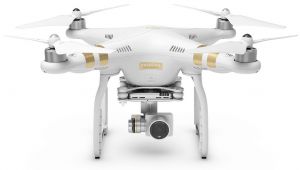
DJI Phantom 3 Advanced
Provided by Osprey Geospatial
Videos
About the Service
Osprey Geospatial Solutions specializes in integrating emerging unmanned aerial system (UAS) technologies with global positioning system (GPS) and geographical information system (GIS) technologies in order to provide top of the line solutions that help our clients succeed. Using both both quad-copter and fixed wing UAS platforms with a variety of payloads (i.e. sensors), Osprey Geospatial strives to maximize our clients’ efficiency while preserving their resources and maintaining optimal data security. These highly efficient UAS platforms, along with our GPS systems, and GIS capabilities and advanced industry knowledge, allow Osprey Geospatial the ability to deliver a variety of solutions to meet your geospatial, geomatic, and mapping needs.
http://www.ospreygeospatial.com/
Drone Models Supported:
 DJI Phantom 3 Professional
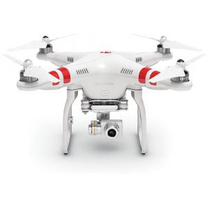 DJI Phantom 2 Vision+
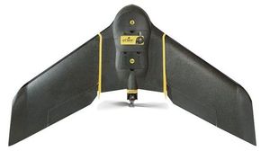
 senseFly albris
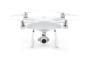 DJI Phantom 4 Professional
 sensefly eBee Plus
About the Drone
Our quadcopter UAV is the perfect platform for capturing aerial imagery for real estate, small area mapping, and 3D modeling of structures.
Experience
Construction
Agriculture
Real Estate
Clean Energy
Drone Features
Camera
Still Camera Resolution:
12.0 megapixels
Built-in Camera:
Yes
Camera Control Range:
-90 to 30 °
View All
Controller
Control Type:
Remote Control + Phone/Tablet
Mobile Device Holder:
Smartphone
Control Type:
5000.0 meters
Live View:
Yes
View All
Drone
Weight:
1280.0 grams
Maximum Flying Time:
23.0 minutes
Maximum Flying Speed:
16.0 m/s
Maximum Flying Altitude:
6000 meters
View All
Extras
SD Card Types:
Micro SD
Pricing
Price
$75.00
Cancellation
Flexible
Weekly Discount
0%
Monthly Discount
0%
About the Provider
Osprey Geospatial Solutions specializes in integrating emerging unmanned aerial system (UAS) technologies with global positioning system (GPS) and geographical information system (GIS) technologies in order to provide top of the line solutions that help our clients succeed. Using both both quad-copter and fixed wing UAS platforms with a variety of payloads (i.e. sensors), Osprey Geospatial strives to maximize our clients’ efficiency while preserving their resources and maintaining optimal data security. These highly efficient UAS platforms, along with our GPS systems, and GIS capabilities and advanced industry knowledge, allow Osprey Geospatial the ability to deliver a variety of solutions to meet your geospatial, geomatic, and mapping needs.
Verification
Email Address
Phone Number
FAA Drone Registration
FAA Remote Pilot Certification
Location