DroneView Technologies
DJI Phantom 4 Professional
Provided by DroneView Technologies
About the Service
As a full service solutions provider serving customers throughout the United States, DroneView Technologies provides market leading expertise and a turnkey solution for Stockpile Measurement and 3D Topographic Mapping for the companies in the Aggregates, Mining, Construction and Solid Waste industries. Our highly skilled, FAA certified pilots and commercial drones or UAVs provide cutting-edge precision while reducing time, equipment, and personnel.
Drone Models Supported:
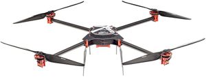 SteadiDrone QU4D X
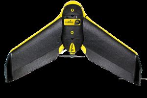 sensefly eBee RTK
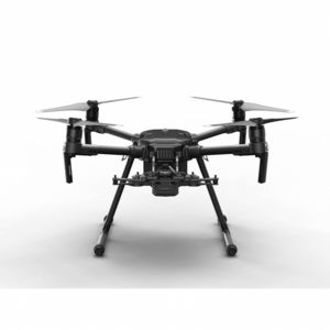 DJI Matrice 210 Series V2
About the Drone
Our drones can save significant time and labor – collect an entire site’s data in hours not days
By having us fly with our phantom 4 pro or eBee Plus we can eliminate the need to purchase expensive survey measuring equipment
Experience
Construction
Agriculture
Real Estate
Utilities
Pipelines
Mining
Clean Energy
Cinematography
Drone Features
Controller
Mobile Device Holder:
Smartphone
Control Type:
7000 meters
Control Type:
Remote Control + Phone/Tablet
Live View:
Yes
View All
Drone
Weight:
1388 grams
Maximum Flying Time:
30 minutes
Maximum Flying Speed:
20 m/s
Maximum Flying Altitude:
6000 meters
View All
Extras
SD Card Types:
Micro SD
Pricing
Price
$275.00
Cancellation
Flexible
Weekly Discount
15%
Monthly Discount
30%
About the Provider
As a full-service solutions provider serving customers throughout the United States, DroneView Technologies provides market-leading expertise and a turnkey solution for Stockpile Measurement and 3D Topographic Mapping for the companies in the Aggregates, Mining, Construction, and Solid Waste industries. Our highly skilled, FAA certified pilots and commercial drones or UAVs provide cutting-edge precision while reducing time, equipment, and personnel.
Verification
Email Address
Phone Number
FAA Drone Registration
FAA Remote Pilot Certification
Location