Mapping/3D modeling, IR imaging
DJI Phantom 4 Professional
Provided by Michael
About the Service
Transmission/Distribution structure inspection; mapping and stockpile reports in the aggregate and mining sector; Commercial Real Estate and Construction Progress services.
Drone Models Supported:
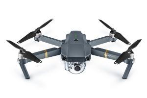
 DJI Mavic Pro
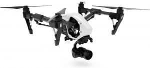
 DJI Inspire 2
About the Drone
DJI Phantom 4 Pro: the industry standard for high resolution photography and video, the 20MP sensor and mechanical shutter of the P4P make it the drone of choice for both 3D modeling and topographic mapping applications.
Experience
Construction
Insurance Claims
Real Estate
Utilities
Mining
Clean Energy
Drone Features
Controller
Control Type:
7000 meters
Control Type:
Remote Control + Phone/Tablet
Mobile Device Holder:
Smartphone
Live View:
Yes
View All
Drone
Weight:
1388 grams
Maximum Flying Time:
30 minutes
Maximum Flying Speed:
20 m/s
Maximum Flying Altitude:
6000 meters
View All
Extras
SD Card Types:
Micro SD
Pricing
Price
$500.00
Cancellation
Flexible
Weekly Discount
20%
Monthly Discount
30%
About the Provider
FAA Part 107 certified since November, 2017; Level I sUAS Thermographer (FLIR certified: August, 2019); Recent experience in Transmission and Distribution inspection; Dozens of successful mapping missions flown for Drone Base in the aggregate and mining sectors. Valid Passport, clean driving record and reliable transportation.
Verification
Email Address
Phone Number
FAA Drone Registration
FAA Remote Pilot Certification
Location


