Aerial Visions
DJI Phantom 4 Professional
Provided by Gary
About the Service
Aerial photography, mapping and inspections. Four years experience aerial inspections of homes and commercial buildings. To include but not limited to hard to access roofs and high rises. Real estate photography to increase sales exposure and increased action on listed properties. 3D and crop health mapping experience for ranches in Texas. Also, keep up with livestock inventory, health and search.
Drone Models Supported:
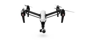
 DJI Inspire 1
About the Drone
Using the DJI MavicPro. Multiple batteries, camera filters. Small drone with 4-mile range, easily deployed state of the art controls. Small, quiet, stealthy. Able to access small entries and areas.
Also, have use of DJI Inspire with FLIR Zenmuse XT thermal radiometric camera for mechanical inspections, search & rescue, crop health irrigation, livestock counting, and health. Commercial building inspections, industrial inspection.
We have added the Phantom 4 Pro v2 to our fleet. The camera has a larger 1-inch sensor for greater detail in our mapping and modeling as well as improved photo and video quality.
Experience
Construction
Agriculture
Insurance Claims
Real Estate
Drone Features
Controller
Control Type:
7000 meters
Control Type:
Remote Control + Phone/Tablet
Mobile Device Holder:
Smartphone
Live View:
Yes
View All
Drone
Weight:
1388 grams
Maximum Flying Time:
30 minutes
Maximum Flying Speed:
20 m/s
Maximum Flying Altitude:
6000 meters
View All
Extras
SD Card Types:
Micro SD
Pricing
Price
$150.00
Cancellation
Regular
Weekly Discount
20%
Monthly Discount
30%
Reviews
1 Review
Summary
Communication
Value
Represented
Provided
Battery
Location


