
Mapping
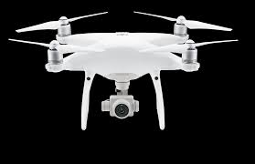
DJI Phantom 4 RTK
Provided by Ecological Solutions, Inc.
About the Service
We use a field survey procedure that utilizes ground control points, check points, and scale constraints, which are geolocated using precision GPS, to ensure that our maps and models created from drone imagery are accurate and precise. Deliverables from us are easily integrated into engineer and design software programs (e.g., AutoCAD, ArcGIS, etc.) which allows for increased efficiency and cost savings when project managers and investors request updates and design data for ongoing projects. We also use multiple GIS, LiDAR and photogrammetry software programs to create customized deliverables that suite the needs of our clients.
About the Drone
The Phantom 4 Pro (P4P) has long been recognized as the industry standard workhorse across multiple industries. This includes mapping, inspection, and surveying. We love this drone for its flexibility, high-definition imagery and video, large 1-inch sensor for capturing point cloud data information, and much more. We are easily able to use the P4P for accurate and precise mapping, especially when used with ground control points (GCP's). With the recent release of the Phantom 4 RTK (with mobile base station), we have seen an amazing level of accuracy and precision in our mapping deliverables with a significant reduction in the use of GCP's, which results in less time in the field and cost savings for our clients. All without sacrificing any amount of accuracy and/or precision. As a standard field check of our equipment, we still employ GCP's, checkpoints, and scale constraints; however, we need far fewer than was previously needed to create accurate maps and models.
Experience
Construction
Agriculture
Insurance Claims
Real Estate
Utilities
Mining
Clean Energy
Cinematography
Pricing
Price
$120.00
Cancellation
Regular
Weekly Discount
5%
Monthly Discount
10%
About the Provider
We are an environmental consulting firm located in Roswell, GA. We offer a wide variety of environmental services and surveys, including drone surveys. We specialize in customized aerial mapping and inspection surveys with drones as well as creating 2D orthomosaics and 3D models for our clients. We have a full time GIS staff that conduct project-specific spatial analysis to produce customized deliverables for our clients across a wide variety of industries (conservation, transportation, power, commercial/industrial construction, aggregate/stockpile, waste management [MSW and C&D], roofing, pavement analysis, agriculture, and many more). Our pilots are flight trained, FAA Part 107 Certified, and insured with an annual policy up to $5M. We regularly coordinate with the FAA and air traffic control towers when necessary in order to comply with all regulations and to improve safety for our drone missions. Our safety record is impeccable due to our pre-flight planning and checklist procedures. We operate the Phantom 4 RTK (with mobile base station), Phantom 4 Pro, and Inspire 1 Pro v2 with FLIR XT (thermal). We are able to rent many other drones in short notice should that be necessary to fulfill a client's needs. We would love to be your go-to drone service provider in the southeast.
Verification
Email Address
Phone Number
FAA Drone Registration
FAA Remote Pilot Certification
Location