
Aerial Mapping & Photogrammetry
DJI Phantom 4
Provided by Wood Rodgers, Inc.
Videos
About the Service
Built and sustained on the firm belief to provide quality services, Wood Rodgers, Inc. was founded in 1997 by two engineers, Rich Wood and Mark Rodgers. We have since grown into a unique firm in which innovation and precision are equally as important as the ability to deliver projects on time and within budget. We take pride in the fact that each project we undertake is equally as important to us as it is to our clients. Our staff includes professionally registered civil, water resources, structural, geotechnical, and transportation engineers, professional land surveyors, geologists, hydrogeologists, floodplain managers, project management professionals, geographic information systems professionals, transportation and land planners, landscape architects, and LEED AP staff who have extensive experience with maneuvering through highly political processes and successfully completing both public and private projects with a high rate of measureable success. Our versatile and reliable team has worked seamlessly with other designers, engineers, public agencies, and private clients to provide quality engineering services, while meeting the environmental constraints of each project. Wood Rodgers is headquartered in Sacramento with additional offices located throughout California and Nevada. We take pride in the fact that the principals and management staff are closely involved with the work product and are responsive to clients’ needs. Our existing relationships with federal, state, and local agencies, as well as our partnering sub-consultants, ensure the successful completion of our projects. We believe that our clients’ success is our success.
Drone Models Supported:
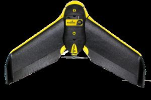 sensefly eBee RTK
 Custom Built Drone
About the Drone
We fly the DJI Phantom 4, which is best suited for oblique imagery and video, inspection, and small area (<100 acre) mapping. We also fly the senseFly eBeee RTK which is a great platform for larger scale mapping projects from 100's to 1000's of acres.
Experience
Construction
Utilities
Pipelines
Mining
Clean Energy
Cinematography
Drone Features
Camera
Still Camera Resolution:
12.0 megapixels
Built-in Camera:
Yes
Camera Control Range:
-90 to +30 °
View All
Controller
Control Type:
Remote Control + Phone/Tablet
Control Type:
5000.0 meters
Mobile Device Holder:
Smartphone
Live View:
Yes
View All
Drone
Weight:
1380.0 grams
Maximum Flying Time:
28.0 minutes
Maximum Flying Speed:
20.0 m/s
Maximum Flying Altitude:
6000 meters
View All
Extras
SD Card Types:
Micro SD
Pricing
Price
$140.00
Cancellation
Flexible
Weekly Discount
10%
Monthly Discount
10%
About the Provider
Wood Rodgers has an Unmanned Aerial System (UAS) program that includes both fixed wing and multi-rotor aircraft that can be deployed for site reconnaissance, aerial photography, and topographic surveying and mapping. The ability of an unmanned system to capture aerial imagery and 3D spatial data provides accurate, safe, and affordable information in support of engineering analysis and design.
These tools leverage the latest in technology to bring added value to our overall services. Our operators are Federal Aviation Administration certified, and are experienced professionals in their respective engineering and land surveying fields.
Verification
Email Address
Phone Number
FAA Drone Registration
FAA Remote Pilot Certification
Location