
Aerial Solutions WNC
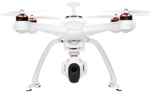
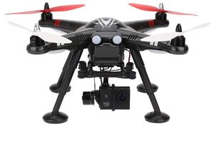
Yuneec Typhoon H
Provided by Aerial Solutions WNC
About the Service
We work with local realtors for real estate project; local agribusiness for crop survey, photogrammetry, and inspection; radio stations for tower inspection; solar farm owners for IR panel inspection; local law enforcement and first responders for search and rescue (all SAR work is done at no charge).
Our services also include local events, news, and sports. We work with the local papers to provide free aerial photography in the event of a major incident (fires, floods, etc.)
We also work with local governments to help with business growth and tourism.
Events such as parties and weddings are photographed from above only. For the safety of the participants, no "artistic" video will be taken by UAVs.
Drone Models Supported:
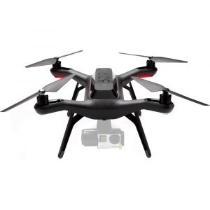 3D Robotics Solo
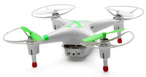 Cheerson CX-30C
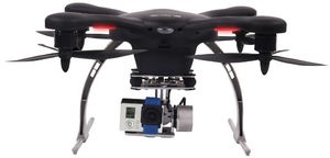 EHang Ghost Aerial Plus
 Blade Chroma
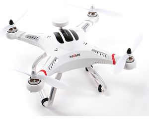 Hobby King Quanum Nova
 Action Drone AD1
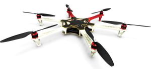 DJI Flame Wheel F550
 XK Detect X380-C
 Cheerson CX-10D
 AEE Toruk AP11+
 DJI Phantom 4 Professional
 Custom Built Drone
About the Drone
We have several drones in our fleet and are always updating to provide better service to our clients. For real estate, our Yuneec Typhoon H 4K is at the top of the heap. It provides the best stability and clearest video. The Typhoon is also our go-to for solar farm inspection using an infra-red camera.
For wooded real estate and SAR (search and rescue) aerials, we prefer something smaller such as the XK Detect X380, or Autel EVO.
For large agribusiness, photogrammetry, survey, and mapping we use our fixed wing Skyhunter. With its eight-foot wingspan and powerful motor, we can cover a 1,000 acre parcel in about 3.5 hours.
All our fleet use 4K imagery for the sharpest, most detailed images available.
Drone Features
Customizations
Drone:
6 axis Stabilization
Drone
Weight:
1850.0 grams
Maximum Flying Time:
25.0 minutes
Maximum Flying Altitude:
122 meters
Maximum Flying Speed:
10.0 m/s
View All
Extras
SD Card Types:
Micro SD
Pricing
Price
$100.00
Cancellation
Flexible
Weekly Discount
25%
Monthly Discount
30%
About the Provider
I started my career as a photographer in 1972 freelancing for the Atlanta Journal and Constitution I moved on to owning my own studio/lab, shooting news stories, portraits, weddings, events, and pretty much everything else. I have also always tried to give back by helping with police, fire, and ems services on a pro bono basis.
I started flying full-sized aircraft when I was twenty, commercially at twenty-three. Flying and photography have always been my passion and I have always felt blessed to be able to pursue my passions in concert.
I bought my first quadcopter in 2013 as a hobby, but it quickly became much more than that. I began building and flying my own RC aircraft so I could photograph locations from different perspectives. When commercial licenses for UAVs became available, I became a professional drone pilot, working with real estate brokers, surveyors, farmers, chambers of commerce, and event planners. I still love doing volunteer work for local police, fire, and ems organizations, and also work with two SAR (search and rescue) platforms as well as a host of UAV and pilot-based organizations. When it comes to this business safety and meticulous attention to detail have helped me acquire many new clients. I have turned down quite a few as well when asked to do something which was illegal or with which I was uncomfortable. Education of my clients is, to me, an equally important part of my business.
I am still passionate about flight and photography, separately and in tandem, and will continue to do both as long as I'm alive and well.
Verification
Email Address
Phone Number
FAA Drone Registration
FAA Remote Pilot Certification
Location